Selection
What's New v9.0 |
Selection toolbarAll Selection tools are now in a standalone toolbar Select by lineSelect features using a line |

The Selection tools are used to retrieve information about objects that are in the current Selection Layer. It is important to understand that there may be many layers in the map window, but only the ones configured in the selection layer below will have information attached to them. The information is displayed in the Information Panel (to the right of the map).
If there are many layers in your selection, IntraMaps will return all the objects in the Information panel with a tab per selection layer to separate your results

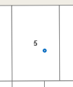
This tool is used to select features in the selection layer, using a point to define the search region.
|
|
|
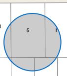
This tool is used to select one or multiple objects in the selection layer, using a circle to define the search region.
|
|
|
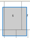
This tool is used to select one or multiple objects in the selection layer, using a square to define the search region.
|
|
|
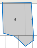
This tool is used to select one or multiple objects in the selection layer, using a polygon or multi sided shape to define the search region.
|
|
|
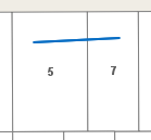
This tool is used to select one or multiple objects in the selection layer, using a line to define the search region.
|
|
|
This tool is used to select one or multiple objects in the selection layer that share a boundary with one object
|
||
This tool is used to select one or multiple objects in the selection layer that are within a specified distance of a selected object
|
||
Each new selection deletes the previous selection and starts one from scratch. Use this tool to add objects to your current selection
Click the tool to deactivate it |
||
Use this tool to remove objects to your current selection
Click the tool to deactivate it |
||
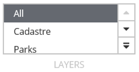
All available selection layers will be in this list. It may be different per module. By default, your selection tools will use select objects from 'All' layers. If you would like to restrict your selection to one layer, choose it from this list. |


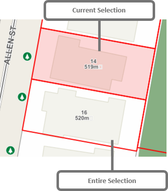
Current and Entire Selection
When you select a large area, IntraMaps will select all the records for that layer. All the records are call an Entire Selection. By default, IntraMaps displays these with a red outline in the map. Your system administrator may change this colour.
The Information panel will show data for the Current Selection. By default, IntraMaps with display this as a light red fill colour.
You can change the Current Selection using the left and right arrows in the Info Panel
![]()